01What the ground is hiding
The Albuquerque Basin looks, from above, like a flat-floored valley between two mountain chains — the Sandia and Manzano mountains to the east, the volcanoes of the West Mesa fringing it to the west. That appearance is misleading in almost every direction. The basin floor is not the bottom of anything. Beneath it, separated from the surface by as much as six to seven kilometres of accumulated sediment and volcanic material, lies the original basement rock that the faults began pulling apart somewhere between twenty-five and thirty million years ago. The flatness is not bedrock; it is fill. And the fill itself is the record.
The Rio Grande rift is a continental rift — a place where two broad plates of crust are pulling away from each other in a roughly east–west direction, thinning the lithosphere and allowing the surface to subside. Along the rift, that subsidence is not uniform. Extension — the literal stretching and thinning of the crust — is concentrated at normal faults, steep fractures where one block drops relative to its neighbour. The Sandia Mountains (35.1°N, 106.45°W) are a tilted fault block, their eastern slope a long gentle ramp of Precambrian granite and Pennsylvanian limestone, their western face a near-vertical escarpment that marks the active fault buried at its base. The range did not rise; the basin beside it dropped, and the mountain appears because one side went down while the other stayed relatively in place.
02The thickness of time
As the basin floor subsided, erosion immediately went to work on the rising flanks. Streams carried coarse alluvial gravel off the Sandias and the Manzano Mountains (34.6°N, 106.4°W) and spread it westward across the basin as bajadas — broad, coalescing aprons of debris. Finer sediment was swept further out into the basin centre, where it settled into floodplain muds and lake beds. Volcanic ash fell periodically from eruptions to the north and west. All of it accumulated, compacted, and was buried by the next episode. The result is a thick, heterogeneous column that geologists call basin fill: interbedded gravels, sands, silts, clays, and volcanic horizons stacked one on top of another and preserved under their own weight.
The thickness of this column in the Albuquerque Basin is known partly from drill records and partly from geophysical surveys. Gravity measurements, which respond to the density contrast between light sedimentary fill and denser basement rock below, indicate that the fill reaches roughly six kilometres near the basin's deepest axis. USGS work on the basin's gravity signature has been central to constructing this picture. That depth implies an enormous volume of material produced, transported, and deposited over the rift's history — and it means the faults that bound the basin have accommodated several kilometres of vertical displacement since rifting began.
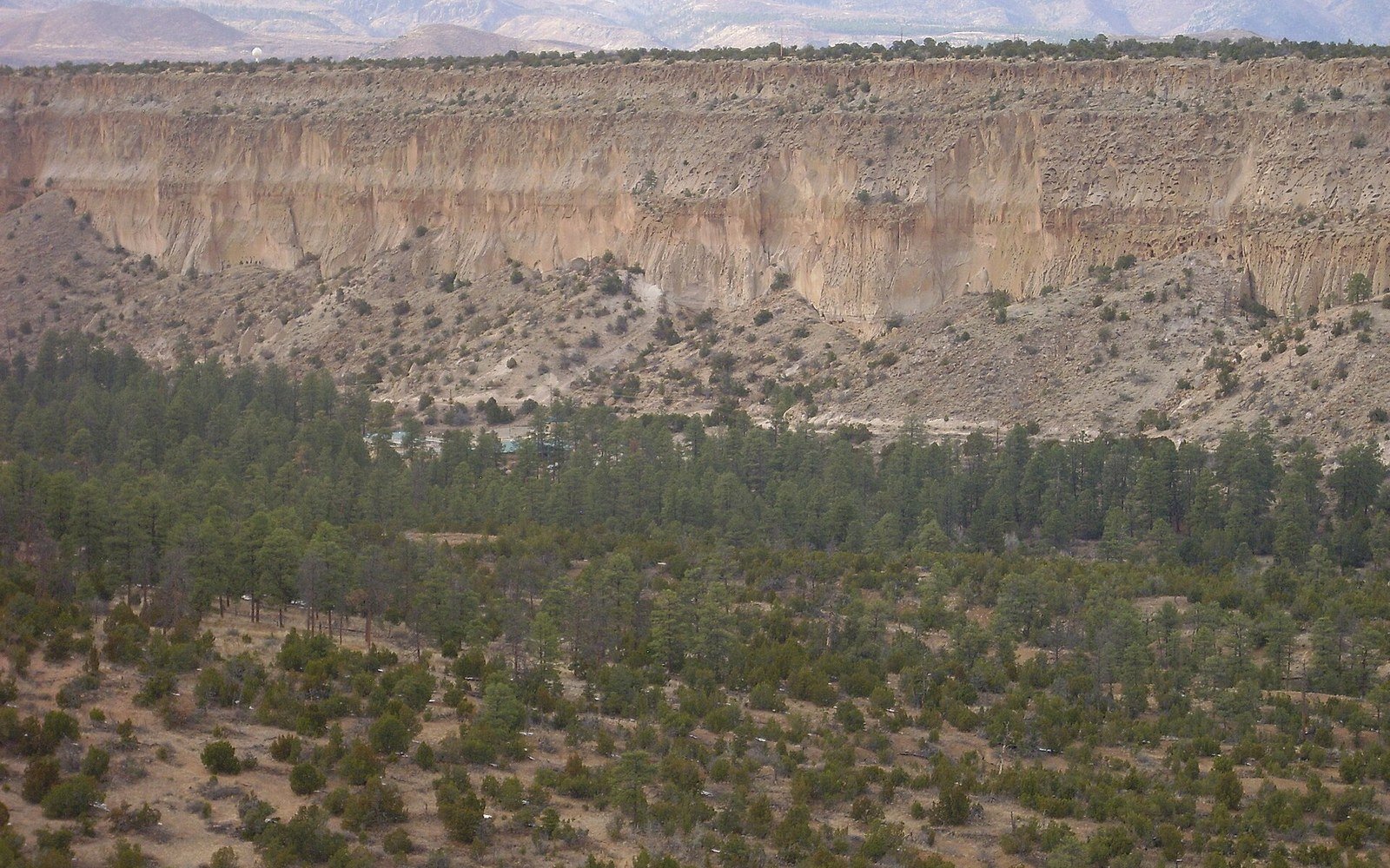
The fill is not anonymous rubble. Geologists studying it in outcrop and core have named it the Santa Fe Group, a broad stratigraphic unit that spans much of the rift's active history. Within it, different facies — different sedimentary environments recorded in the rock — tell the story of how the basin evolved. Coarse conglomerates near the fault scarps thin and fine toward the centre. Volcanic ash beds serve as time markers, since the eruptions that produced them can often be dated radiometrically. The Jemez Mountains (35.8°N, 106.5°W) to the northwest have delivered some of the thickest and most distinctive of these markers: the Bandelier Tuff, erupted from the Valles Caldera around 1.6 and 1.25 million years ago, appears throughout the region as a pale, welded tuff and reworked pumice layer that geologists use to correlate sections across considerable distances.
03Reading the surface above it
Almost none of the basement is directly visible within the basin itself, but the surface gives clues about what is happening below. The West Mesa escarpment, at roughly (35.15°N, 106.75°W), is the eroded eastern edge of a basalt lava field — flows that poured across the basin floor between about 156,000 and 70,000 years ago. Those flows cap the softer Santa Fe Group sediments beneath, protecting them from erosion and creating the sharp edge that defines the mesa. At Petroglyph National Monument, the basalt boulders along the escarpment face carry desert varnish, the dark manganese-and-iron coating that forms slowly on exposed rock surfaces in arid climates, and into that varnish Ancestral Pueblo and other Native peoples pecked tens of thousands of images over several thousand years. The varnish is a geological product; the images are a human record. Both exist because the basalt was here, and the basalt was here because of what the rift did to the landscape.
Geologists studying it in outcrop and core have named it the Santa Fe Group, a broad stratigraphic unit that spans much of the rift's active history.
Ladron Peak (34.39°N, 107.05°W) stands well out into the basin to the southwest, an isolated mass of old rock that erosion has not yet buried. It is an inlier — a piece of pre-rift basement exposed within the otherwise filled basin, a reminder that the fill is not endless in all directions and that the buried landscape has its own topography, mountains beneath the sediment that the drilling record occasionally encounters at unexpected depths.
Beneath Socorro (34.06°N, 106.89°W), the rift zone takes an unusual turn: a large body of magma, the Socorro magma body, sits in the mid-crust at roughly nineteen kilometres depth, and the ground above it has been measurably inflating. The USGS and New Mexico Tech have documented this inflation through geodetic surveys; UNAVCO operates continuous GPS stations across the rift whose data makes present-day motion legible in millimetres per year. That motion is real and ongoing. The basin is still dropping. The faults are still moving.
04Why the fill is the measure
The depth and character of the basin fill are not merely geological curiosities. They are the primary record of how fast rifting has proceeded and how the geometry of faulting has changed through time. A thin fill means slow subsidence or a short history; a thick fill means sustained fault motion over a long period. In the Albuquerque Basin, the fill is thick enough to indicate that the major bounding faults have been active for tens of millions of years, with rates that have likely varied as the rift evolved. The New Mexico Bureau of Geology and Mineral Resources holds drill logs, gravity data, and mapped stratigraphic sections that underpin much of what is known about this column. Without the fill, there would be no record of how far the blocks have moved. The rift would be a structure without a history. Instead, every layer of gravel carried off the Sandias, every ash fall from the Jemez, every flood deposit from an ancestral Rio Grande is another line in a document the basin has been writing since the crust first began to pull apart.